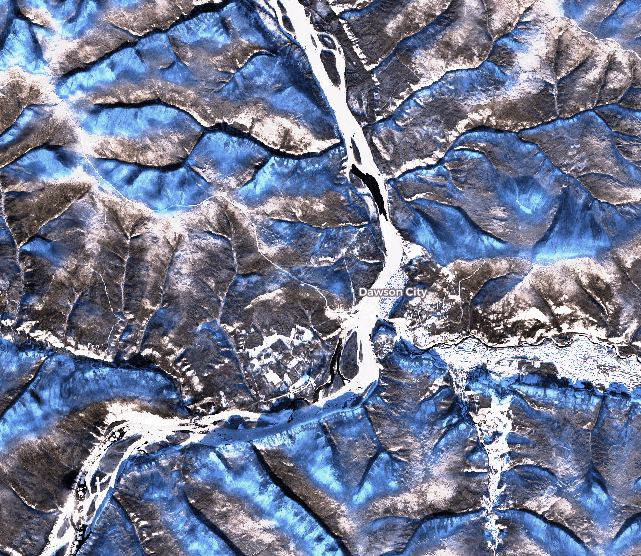
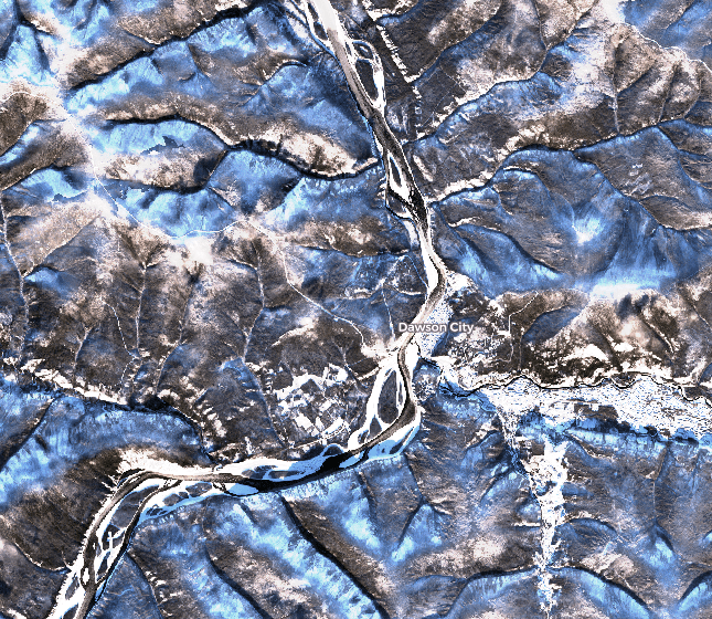
The ice cover formed in front of Dawson during the night of Halloween (Oct. 31st to Nov. 1st), which is a few days earlier than in previous years. The good news is that the ice cover now extends from bank to bank at the ferry crossing / ice bridge location.
The initial river ice congestion point was located 100 km downstream of Dawson towards Alaska, as it is normally the case. However, this year, the upstream progression of the ice cover (by drifting ice and frazil interception) was uninterrupted over more than 120 km, and this process is continuing upstream towards the White River delta as these lines are being written.
This freeze-up process, at a higher-than-usual discharge (or river flow), may result in a more resistant ice cover, which is one of many ingredients leading to high river ice breakup water levels in the spring.
A model that attemps to predict the formation (timing and pattern) of the ice cover on the Yukon River at Dawson will be presented at the 25th IAHR International Symposium on Ice at the end of November.
The following Sentinel II satellite images show ice conditions on the Yukon River at Dawson on Oct. 30th and Nov. 1st (below).